A SHORT RIDE THROUGH GRANITEVILLE CA. OCT. 2010
(DON'T BLINK)
I took a quick ride on the XR600R up to Anders place between North Columbia and Graniteville to check on the progress of his new barn/shop we designed and I drafted. After visting Anders, I headed up to Graniteville just up N. Columbia Rd. and shot the video above. That's "Rosie" the dog/town greeter at the end of the street.
http://maps.google.com/maps/ms?hl=en&ie=UTF8&msa=0&msid=104083886384131166529.00049355ccfe961fc25bc&ll=39.436458,-120.816994&spn=0.091745,0.181789&t=p&z=13
CLICK ON FOR LARGER VIEW
Here's the rocky thru section Google maps does not show.
After Graniteville, I doubled back down North Bloomfield Rd. to Moore's Flat Rd.(rt.) to German Bar Rd. (rt.) which turns into Plumbago Mine rd. in an effort to cross the S. Fork Yuba River. The road gets steep and rutted as you head down the Yuba River Canyon.
TYPICAL RELIC
ALONG PLUMBAGO MINE RD.
PLUMBAGO MINE RD.
CROSSING S. FORK YUBA RIVER
APPROACHING THE BRIDGE
COUNTY LINE AT THE RIVER
Crossing the Yuba the Plumbago rd. gets very rocky, lotsa prime gold bearing quartz. Soon you see the red roofs of the Plumbago Mine, not currently active, but still occupied. The region is littered with hard rock and placer mines, there is not a single rock that has not been turned over by gold seekers.
WHAT A GOAT TRAIL!
PLUMBAGO MINE
Long since unproductive, I believe the Sixteen to One Mine in Alleghany has bought the rights.
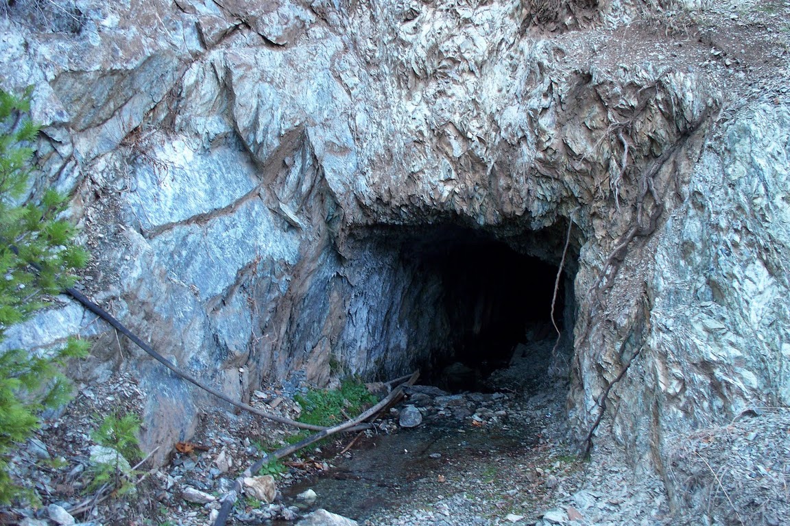
SHAFT ENTRY
Continuing up the road you find the upper Plumbago.
Then there is one more crossing before Alleghany-Kanaka Creek named after some Hawaiians (Sandwich Island) folks that settled in the area during the gold rush.
THE OLD KANAKA CREEK BRIDGE
THE NEW BRIDGE
A few more miles of twisties and you are back to civilization -Alleghany!
"BEER, BOOZE AND BURGERS"
CASEY'S PLACE-ALLEGHANY CA.
With storm clouds approaching and rain showers blowing across the canyons, I blasted back home to Nevada City via Foote's Crossing Rd. to Foote's Crossing (middle fork Yuba) then N. Bloomfield Rd. to Edwards Crossing (S. Fork Yuba) and home. about a 1 hr. ride.
Foote Crossing Rd. is another great Nevada County Backroad featuring hand built rock walls that I'll save for a later time....
BACK IN NEVADA CITY!
(PLEASE SOMEONE REOPEN THIS PLACE SOON)
LINKS TO ORIGINAL NCHS BULLETIN ON GRANITEVILLE
PUBLISHED APRIL 1972


